Why this house, again?
You are under a fixed path into or out of an airport. The aircraft are not choosing your roof. The procedure is.
The sky outside
What are planes overhead? Usually four ordinary things at once. A published path that repeats over the same houses. A height, high in the cruise and much lower near a runway. A flight number that looks different on a ticket and on a tracker. And, far from land, a public map that goes blank while the flight itself carries on.
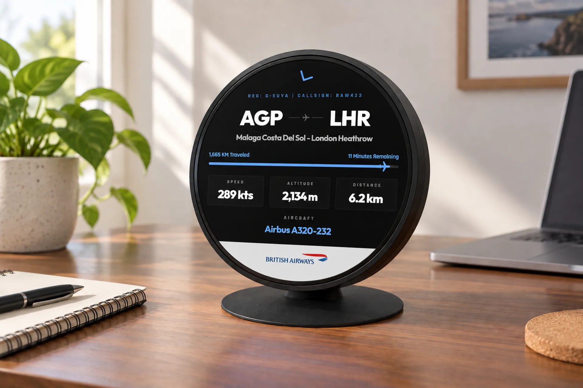
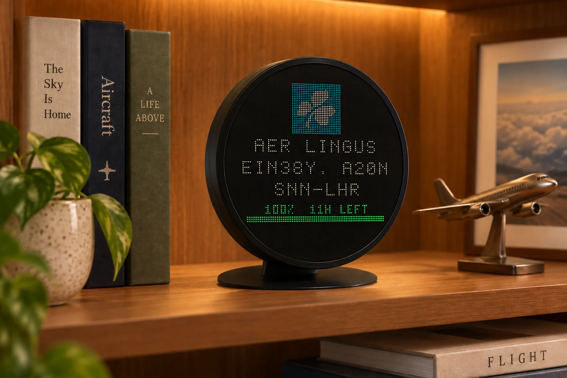
None of that means something has gone wrong. It is how routes, radios and airports are built. FlightAbove is for the part you can hear: the callsign, the height, the route and a photo of the type, out to 250 km from the house.
In one glance
You are under a fixed path into or out of an airport. The aircraft are not choosing your roof. The procedure is.
Cruising airliners are usually 33,000 to 42,000 feet up. The one that rattles the windows near a runway is a few thousand feet, or less.
An airline code plus digits. BA286 on a pass is BAW286 in the air, spoken as Speedbird. Same flight, two code systems.
The public map lost the radio, because there is no receiver in the middle of the ocean. Controllers did not lose the aircraft.
The repeating line
Airliners do not draw a straight pencil line from city to city. They follow published routes made of named points. Around a busy airport those paths squeeze through a few arrival and departure gates. If the house is under one of them, almost every aircraft on that procedure crosses the same patch of sky.
The pattern shifts when the wind does. Take-off and landing are into wind, so a change of direction flips which runway is in use and the overhead line moves. A few airports, Heathrow among them, also swap on a schedule so the same streets are not always the ones underneath. At night the set changes again: many airports limit movements, and what remains is often cargo and long-haul, which is why the early flight sounds unlike the daytime ones.
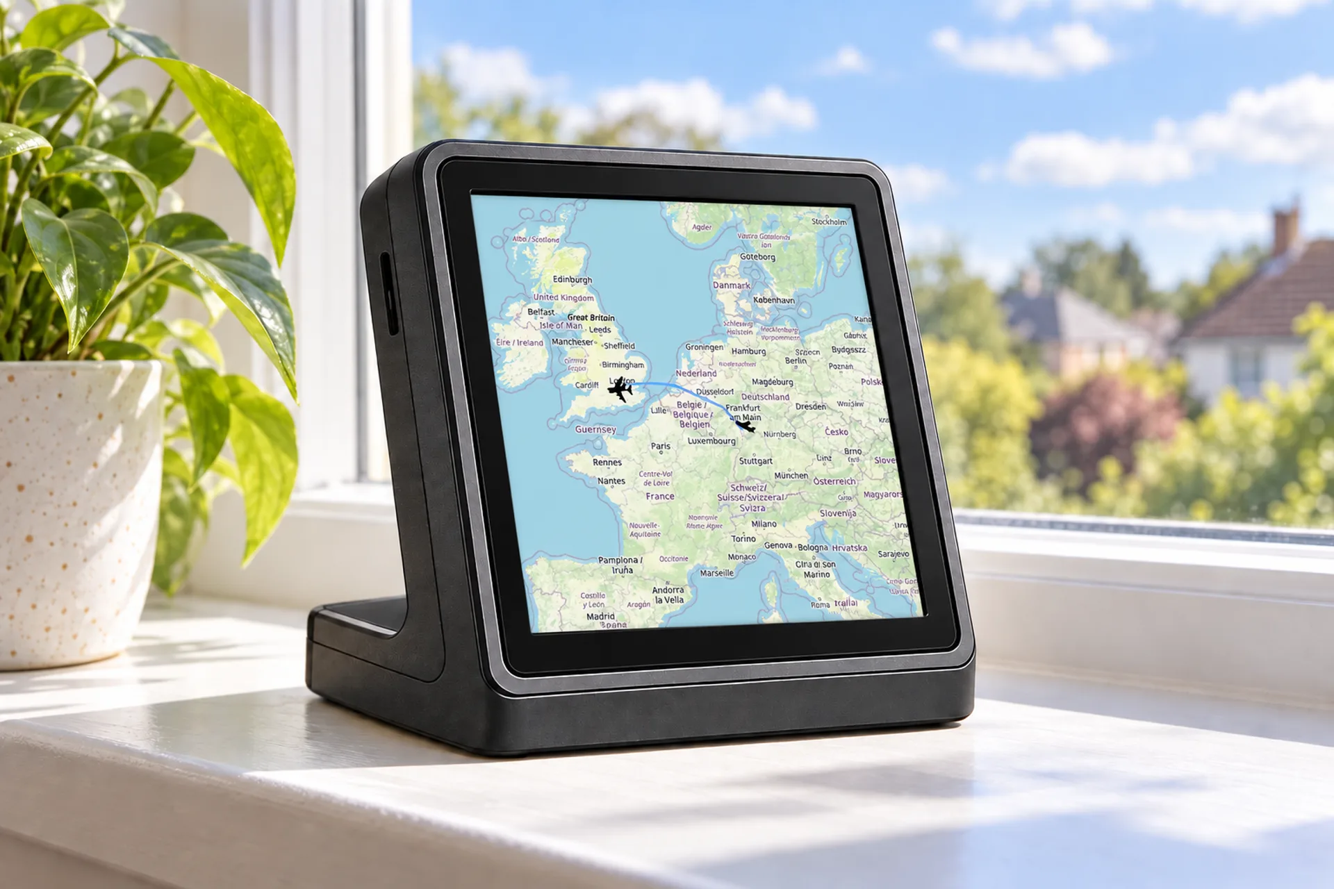
The house is under one published path.
The runway in use turned around with the wind.
Night limits leave cargo and long-haul.
Often it was louder. The height on the screen settles it.
The number in feet
Most airliners cruise between about 33,000 and 42,000 feet. That is roughly 6 to 8 miles up. The air is thin enough that the aircraft meets less resistance and burns less fuel, and most of the weather is below them. A long flight often steps higher as it gets lighter. Business jets commonly sit above the airlines. Turboprops usually stay nearer 20,000 to 25,000 feet. Nothing in ordinary passenger service today cruises where Concorde did, around 60,000 feet.
1,500 ft
A normal approach drops about 300 feet per mile. Five miles out is about 1,500 feet. Ten miles out is about 3,000.
33,000 ft
Most sit between about 33,000 and 42,000 feet. Short flights stay lower in that band. Long flights climb as they lighten.
25,000 ft
Often around 20,000 to 25,000 feet. Still well above the houses, and well below a jet cruise.
A few thousand
Training flights and many private aircraft live down here, which is also why they fade off maps sooner.
Above a set height, crews stop using the local pressure and share one standard setting, so vertical gaps between aircraft stay honest as the weather changes. Trackers often print that as a flight level: FL350 is 35,000 feet on that shared setting. FlightAbove shows the height in feet next to the flight, which is how you tell a loud aircraft from a low one. They get mixed up all the time, and they are not the same thing.
Two codes, one flight
A flight number is an airline's code with one to four digits after it. The confusing part is that there are two codes. Tickets and departure boards use two characters: BA, FR, VS. The aircraft broadcasts three letters: BAW, RYR, VIR. British Airways 286 is BA286 on the pass and BAW286 on a tracker. On the radio the crew says Speedbird.
The digits are habit more than law. Lower numbers are often the older or longer routes. Even and odd numbers often mark the two directions, though which way round depends on the airline. Numbers up in the thousands are frequently a partner airline, a charter, or a seasonal flight sold under the main brand. easyJet is the odd one out people notice: its ticket code and its broadcast code are both EZY, so the number barely changes.
A codeshare adds one more twist. Several airlines can sell seats on one aircraft, each with its own number. The aircraft broadcasts a single callsign, the airline actually operating it. After a fatal accident, airlines almost always retire that number on the route. Nothing in the rules forces it. It is a custom. The city pair beside that number is a lookup, not part of the broadcast: where a flight route comes from.
| On the pass | On a tracker | On the radio |
|---|---|---|
| BA286 | BAW286 | Speedbird |
| FR812 | RYR812 | Ryanair |
| EZY602 | EZY602 | Easy |
| VS25 | VIR25 | Virgin |
The empty ocean
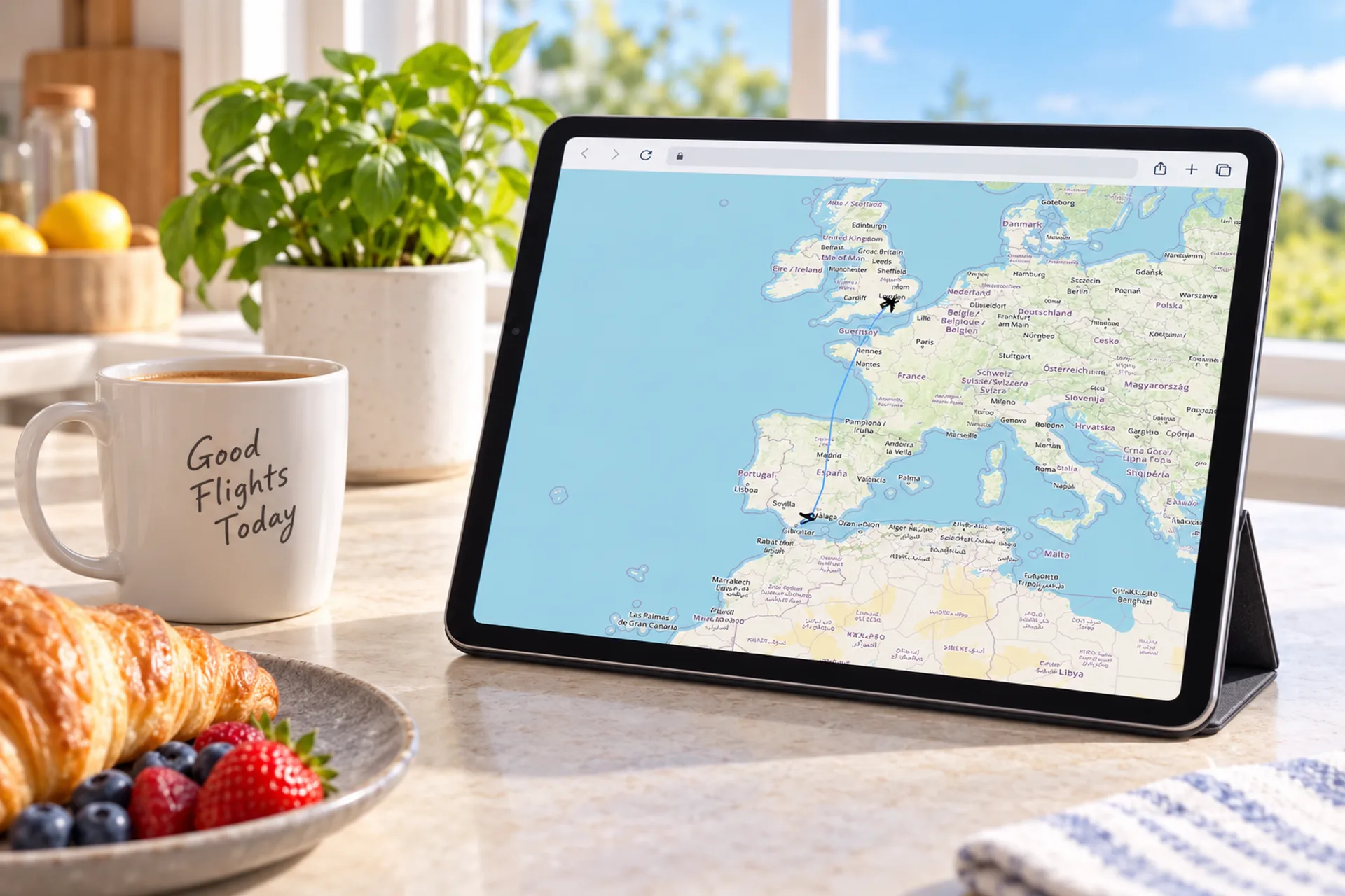
A public tracker is only as good as whoever can hear the aircraft. The position report is a radio broadcast on 1090 MHz, sent about twice a second. It travels in a straight line, so the curve of the earth limits it. From a cruising airliner that reach is hundreds of kilometres. Over the North Atlantic there is open water for far longer than that, and nowhere to stand a receiver.
The aircraft does not stop transmitting, and air traffic control does not stop following it. Oceanic control uses reported positions, time, distance and satellite links rather than a continuous ground picture. Watch a transatlantic flight and the dot often fades west of Ireland, then returns near Newfoundland. Nothing failed. The free map ran out of ears.
Satellites can hear the same broadcast over water, and that has improved oceanic control. The feed is sold into the operational world. Most free maps still draw only what ground receivers collect, so the ocean stays a gap. The same gap appears over deserts, parts of the Arctic, and anywhere else without a listener. How aircraft tracking works is the longer version of the radio itself.
Usually on the map. Receivers are close enough, and the radio horizon is long.
Usually off the free map. No ground receiver in range. Controllers still have the flight.
Light aircraft drop off sooner. Some never transmit. Military flights can switch the signal off.
The desk, not the ocean
A home display lives on the coverage near you, where receivers are dense and the aircraft are the ones you can hear. It names the callsign, the height, the route and a photo of the type. You set the place, the direction you face, and how far to look, out to 250 km.
When nothing is in that window, the screen is a clock and the weather. It does not invent an aircraft to fill a gap. The Atlantic blank on a public map is a different problem, and a desk display is not trying to solve it. Emergency codes, when one does appear nearby, are a separate story: what squawk 7700 means.
Hardware from £99.00, paid once, produced in the United Kingdom
The aircraft around the house, not every flight on earth.
In feet, so a loud pass and a low pass are not the same guess.
A clock. Not a guessed dot over the sea.
Quick answers
Because your house sits under a published path. Arrivals and departures are threaded through a handful of fixed points, so the aircraft using that path cross the same roofs, day after day.
The wind changed, so the airport turned around. Aircraft take off and land into the wind. When the runway in use flips, the line over the houses moves with it. Some airports also swap runways on purpose so the noise is shared.
In the cruise, most airliners are somewhere between about 33,000 and 42,000 feet, roughly 6 to 8 miles up. Near an airport they are far lower. A normal approach loses about 300 feet of height for every mile closer to the runway.
It is an airline code plus a few digits. The code on a ticket is two characters, such as BA. The code the aircraft broadcasts is three letters, such as BAW. BA286 on a boarding pass and BAW286 on a tracker are the same British Airways flight. On the radio that airline is Speedbird.
Trackers show the callsign the aircraft is broadcasting, which uses the three-letter code. Tickets use the two-character code. On a codeshare, several airlines may sell the same seats, but the aircraft only broadcasts the airline that is actually flying it.
The position report is a radio signal. Someone on the ground has to be close enough to hear it, and in the middle of an ocean there is nowhere to put a receiver. The aircraft keeps transmitting. The public map is the thing with the gap.
Yes. Oceanic controllers separate aircraft with position reports, timing and satellite links, rather than a radar picture of every mile. They know where the flight is. A free tracking map often does not, until the aircraft comes back into range of receivers on land.
A low aircraft can only be heard over a short distance, because the curve of the earth gets in the way sooner. Some older light aircraft and many gliders never send the signal at all. Military flights can switch it off.
What flies over you · Flight tracker display · Aviation gift guide
The one you can hear
Height, callsign and route for the aircraft near the house. Produced in the United Kingdom. Hardware paid once.